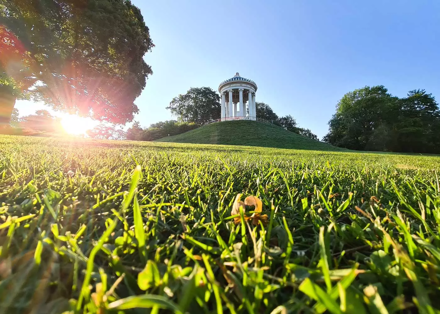
Berchtesgaden: 15 easy (family) hikes amid beautiful scenery
The Berchtesgadener Land and especially the Alpine region is among the most impressive landscapes in Germany.
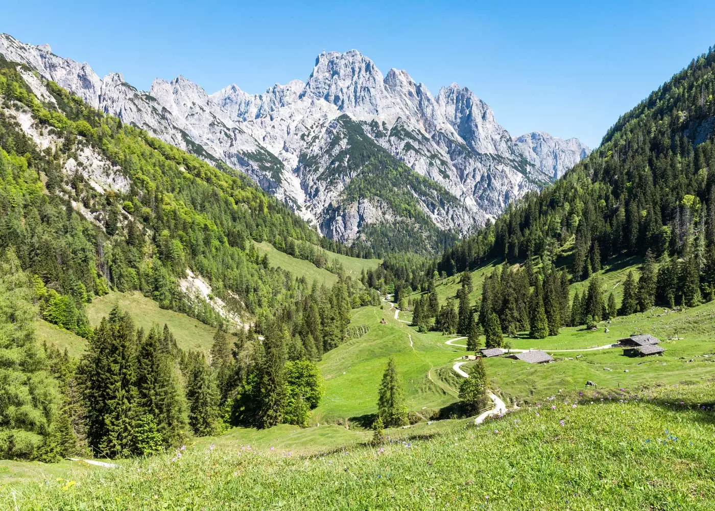
There are many more superb hikes in the Berchtesgaden Alps – and not all of them are reserved for professionals. In the Berchtesgadener Land, there are a lot of easy tours suitable for beginners and families with children. We want to show you 15 of these dream tours amid breathtaking scenery.

Hi! Wir sind Biggi & Flo
Wir nehmen dich als Reisejournalisten mit zu den schönsten Orten der Welt!
Werbehinweis: Alle mit einem * markierten Links sind Werbelinks.
Hiking in Berchtesgadener Land
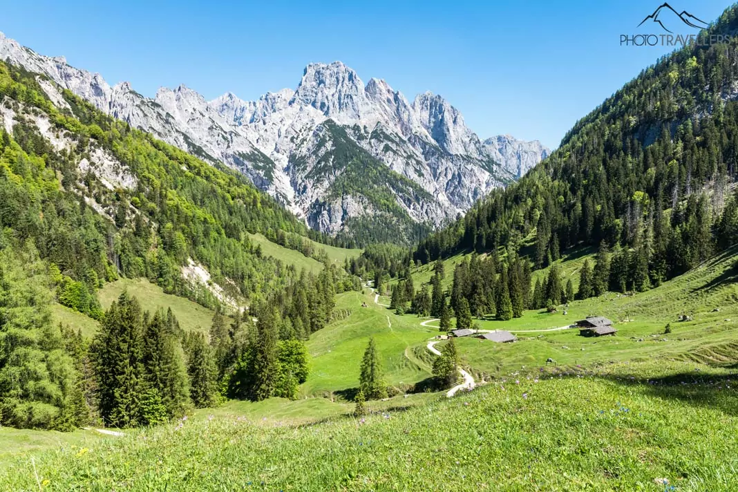
Next to the Zugspitze near Garmisch-Partenkirchen, the Watzmann is the most famous mountain in Germany – and also the most distinctive. With its double peak, the Watzmann – located in the Berchtesgaden National Park – can be recognized from afar.
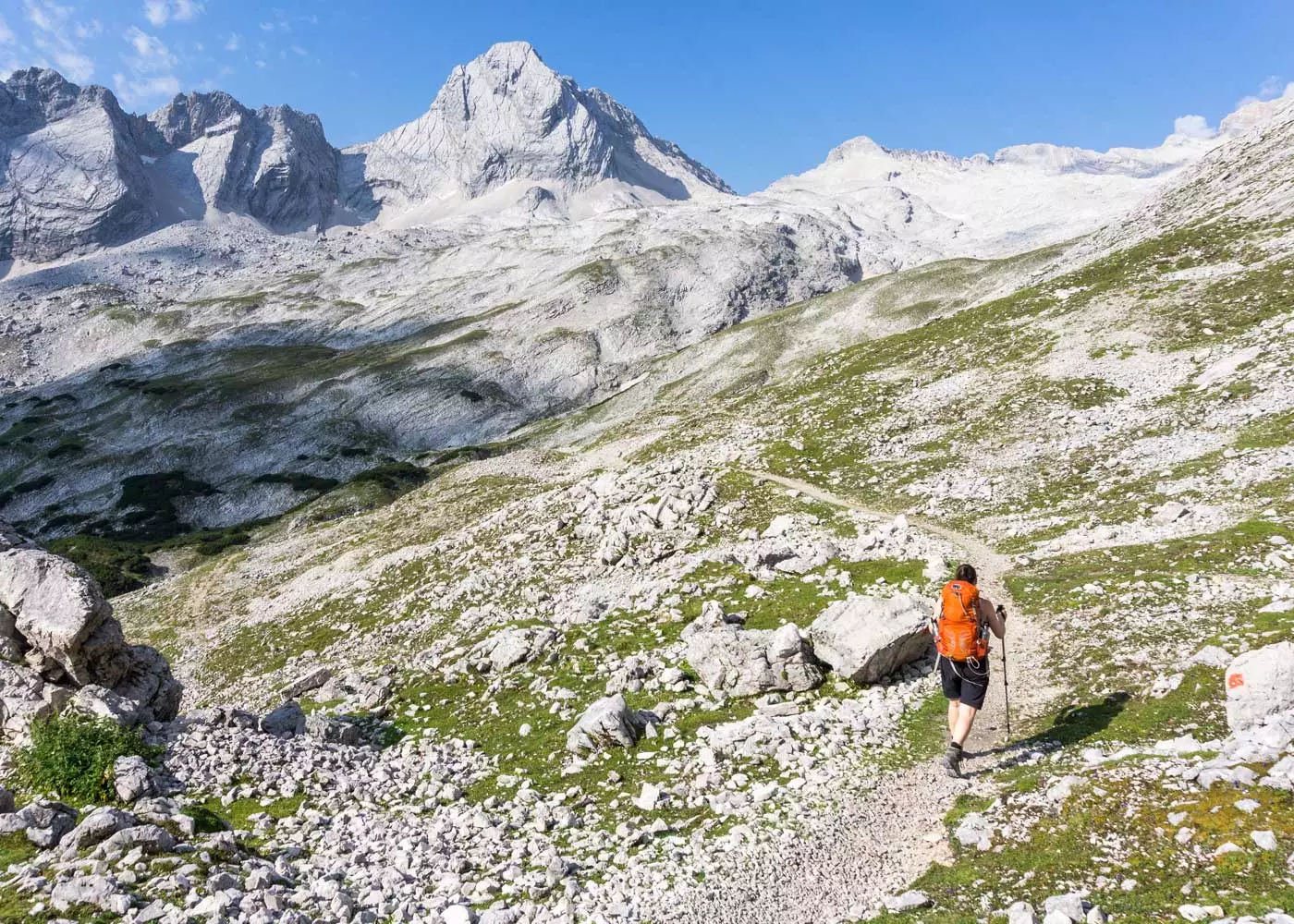
The Watzmann crossing is considered a dream tour among mountaineers, but it requires alpine experience and a lot of stamina. But don’t worry, for beautiful views and great tours, it does not always have to be an extreme mountain hike.
In the Berchtesgaden Alps there are many other first-class hikes – and not all of them are reserved for mountain professionals. We show you the most beautiful mountain tours that you can also do as a beginner or as a family with children.
Map: Easy hikes in Berchtesgadener Land
Here you can find our top hikes in Berchtesgaden on the convenient overview map:
[mapsmarker layer=”31″]
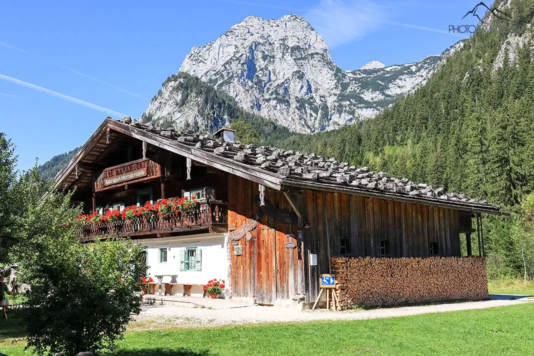
1. Toter Mann
Climbing the 1391-meter high mountain by the name of Toter Mann (translated: Dead Man) – also called “sun terrace of Ramsau” – is a classic hike in the Berchtesgadener Land and doable almost all year round. This easy hike is also well-suited for beginners.
The starting point is the parking site of the mountain inn Zipfhäusl (Schwarzecker Weg 8, 83486 Ramsau bei Berchtesgaden). At first, you follow the street and soon afterwards turn onto a wide road way. When you reach the mountain hut Bezoldhütte, which was built in 1883 at the top of the Toter Mann, you will have covered a distance of four kilometers as well as about 500 meters in height.
The route doesn’t cause any problems and is very popular with families and children. If you’re not in a hurry and take your time, you’ll reach the peak in around two hours. Countless benches and green meadows invite you to enjoy the view of the Watzmann – and let me tell you, it is stunning.
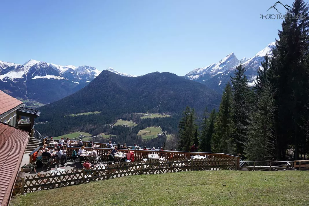
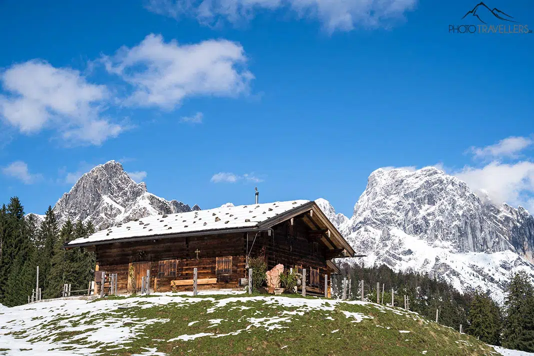
If you’re not keen on the climb, you can take the Hirscheck chairlift to the top. If you’re more ambitious, descend to the saline pipeline path (Soleleitungsweg). The trail requires a bit of surefootedness but is still manageable.
Once you’ve arrived at the saline pipeline path, you’ll be welcomed by the mountain inn Söldenköpfl, which is open all year. The view from here is absolutely breathtaking. A gorgeous forest track – the former saline pipeline path – will take you to the mountain inn Gerstreit. And – you might have guessed it – the view from here is also amazing. From the inn, you can return to the parking site.
Total trail length: 11.9 kilometers (considerably shorter with the Hirscheck chairlift) – Elevation gain: 570 meters
2. Soleleitungsweg
From the mountain inn Söldenköpfl, hikers can enjoy an incredible panoramic view over the mountains. The inn is also one of the stops of the circular hike to the Toter Mann, but if you’re not ready for that tour, start from the parking site at the mountain inn Zipfhäusl (Schwarzecker Weg 8, 83486 Ramsau bei Berchtesgaden).
From there, you can take the Soleleitungsweg to the mountain inn Söldenköpfl, which is a route of about five and a half kilometers. This former saline pipeline path is breathtaking and the view is hard to beat. In total, the round trip adds up to almost eleven kilometers, but the elevation gain is minimal. If that is still too far for you, you can walk a mere three kilometers to the mountain inn Gerstreit.
Total trail length: 10.6 kilometers – Elevation gain: – meters
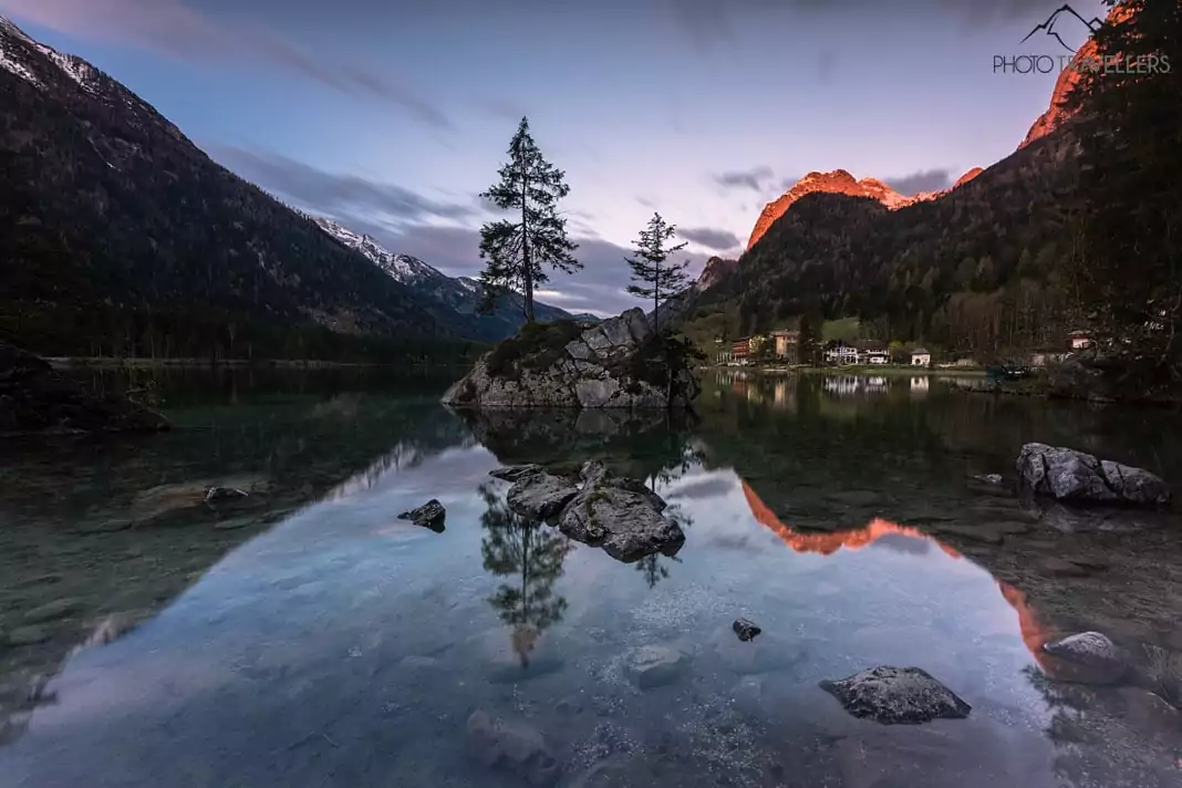
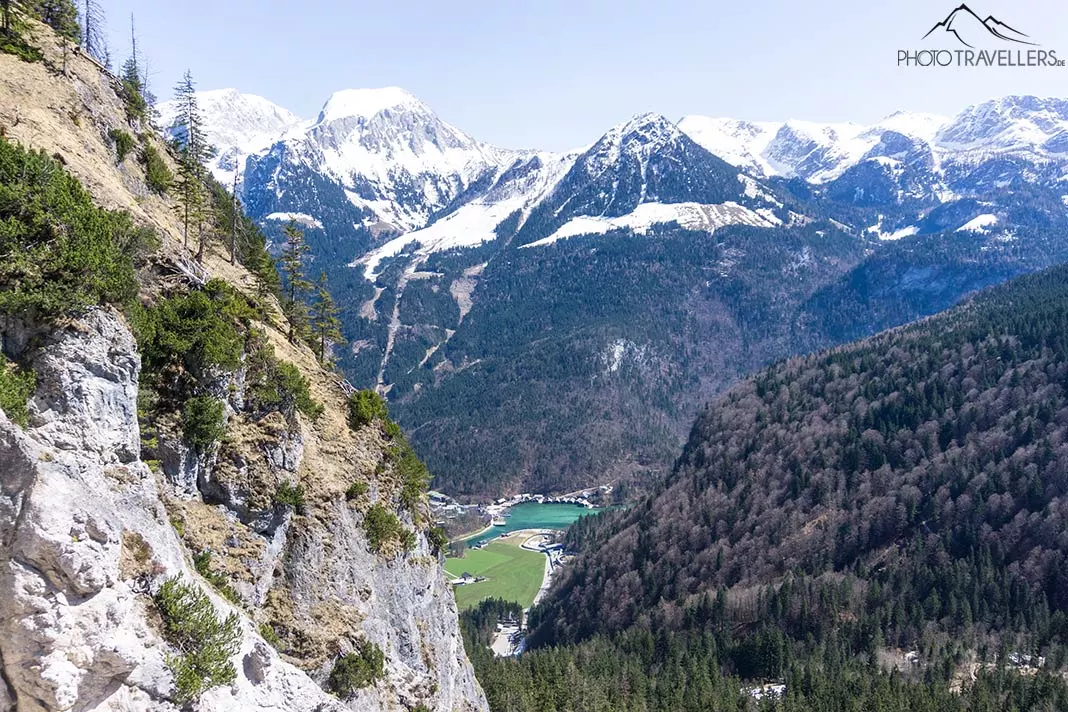
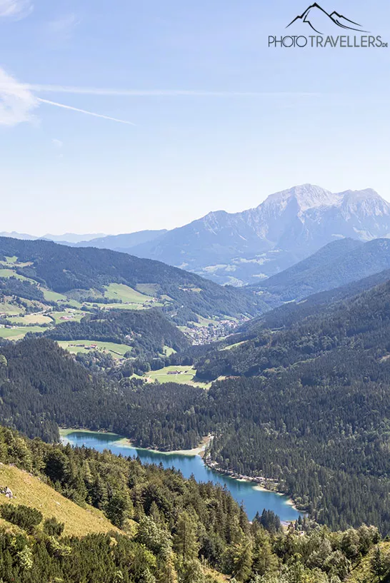
3. Hintersee circular hike
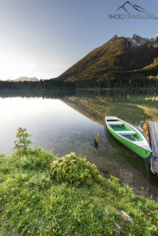
The Hintersee is one of the most beautiful mountain lakes in Bavaria. The short circular hike around the lake is amazingly beautiful, perfectly suitable for families and normally also doable in the winter. However, it can get quite slippery, so you might want to use crampons.
The circular hike around the Hintersee is just under three kilometers long, so you’ll need about an hour. By the way, the lake also provides one of the most well-known photo subjects in the Berchtesgadener Land. In the summer, you can rent a boat and explore the Hintersee on the water.
Total trail length: 2.9 kilometers – Elevation gain: – 0 meters
4. Dötzenkopf
The Dötzenkopf is exactly 1001 meters high and thus the smallest one-thousander in Germany. The hike is ideal for beginners and families with children. As one of the backyard mountains of Bad Reichenhall, the Dötzenkopf is a popular destination among locals, too.
No matter if it’s after work or during lunch break, they go there all the time. From the parking site, a nice trail leads you upwards pretty quickly. It’s beautiful and not that difficult, but it still requires a certain degree of surefootedness as there’s the occasional root or stone tread to overcome.
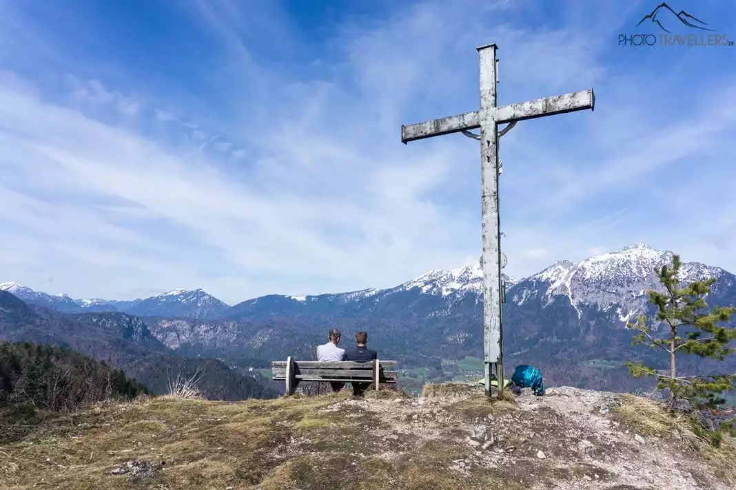
Even though it’s just 1001 meters high, the peak presents a stunning view over Bad Reichenhall and the surrounding mountains. In addition, some benches at the peak call for a delicious snack.
Total trail length: 3.5 kilometers – Elevation gain: 350 meters
5. Almbach Gorge
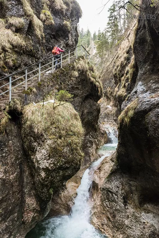
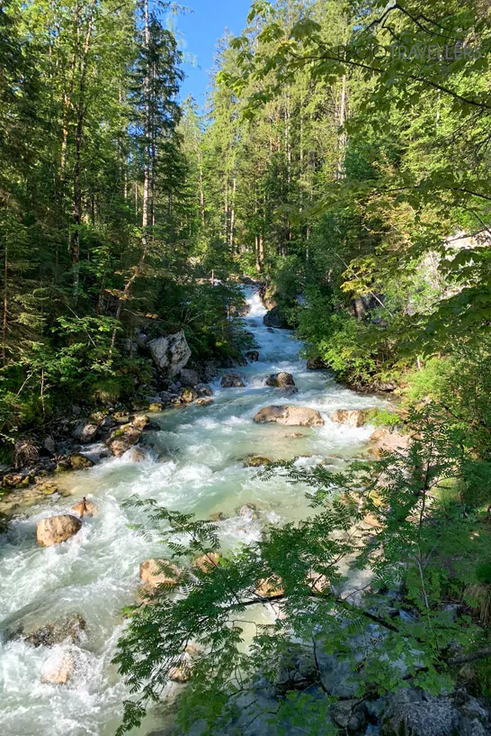
The Almbach Gorge is among the most beautiful gorges in the German Alps. Unlike the Partnach Gorge in Garmisch-Partenkirchen, the Almbach Gorge is not that overcrowded and provides an unforgettable experience of nature.
From the parking site, a broad forest trail runs along the Almbach stream and gets narrower and narrower. The hiking trail through the Almbach Gorge is absolutely GORGEous (pun intended). The path is mostly secured but not at all places. Especially if it’s wet, caution is advised.
The final destination of the hike is the Sulzer Wasserfall, which is the eleventh highest waterfall in Germany with 114 meters. The Almbach Gorge is usually open from May to October and closed during the colder months.
Total trail length: 3.5 kilometers – Elevation gain: 200 meters
6. Grünstein
The 1304-meter high Grünstein is one of the mountains with the best view of the Watzmann. The easiest trail onto the Grünstein starts at the parking site Hammerstiel in Schönau. From there, a broad forest track, which gets narrower along the way, leads you up to the peak in about one and a half hours. This version is also suitable for beginners and families, while the alternative route starting from Schönau am Königssee is a bit more difficult.
At times, this trail can get pretty steep and requires some surefootedness in the upper part, especially when descending over the loose boulders. If you’re looking for a challenge, try taking the Grünstein via ferrata (level of difficulty: B/C, options: D/E). Please be aware that you can only take the via ferrata for going up to the peak – climbing down that path is strictly forbidden.
Total trail length: 8.6 kilometers – Elevation gain: 690 meters
7. Malerwinkel circular trail

The Malerwinkel circular trail runs along the Königssee and is also suitable for families with children. The view of the lake from different viewpoints along the way is truly beautiful. You can reach the Malerwinkel viewpoint after a very short hike; sit down on one of the two benches there to let the gorgeous panoramic view sink in. The circular trail now leads you in the direction of Rabenwand. This short detour is not a must, but definitely worth it.
Total trail length: 4.7 kilometers – Elevation gain: 190 meters
8. Zwiesel
The hike onto the 1782-meter high Zwiesel – the highest peak within the Staufen massif – is a relatively easy mountain tour for the whole family. The view from the peak is really breathtaking. For the hike, you will need a basic amount of stamina and surefootedness, especially in the upper part of the trail.
All in all, the climb is pretty manageable, though. Halfway along the route, you can stop by at the Zwieselalm for food and drinks (private business, open from mid-May to mid-October, in good weather sometimes also drinks in autumn, tel.: +49-8651-3107, no website).
Total trail length: 8.1 kilometers – Elevation gain: 870 meters
9. Kneifelspitze
The hike onto the Kneifelspitze is among the outright hiking highlights in Berchtesgaden. The tour is relatively short and also suitable for beginners. Even though it’s just 1189 meters high, the peak provides a stunning view of the Watzmann .
The starting point of the hike is the pilgrimage Church of Maria Gern, one of the most famous photo subjects in Bavaria. Follow the hiking trail AV-Weg 15, the so-called Kneifelspitzweg. Shortly after the start, you can make a slight detour to the Marxenhöhe, a fantastic viewpoint with some benches to enjoy the amazing view.
At the peak of the Kneifelspitze you cannot only enjoy a great view, but also stop off at the mountain inn Paulshütte.
Total trail length: 6.4 kilometers – Elevation gain: 520 meters
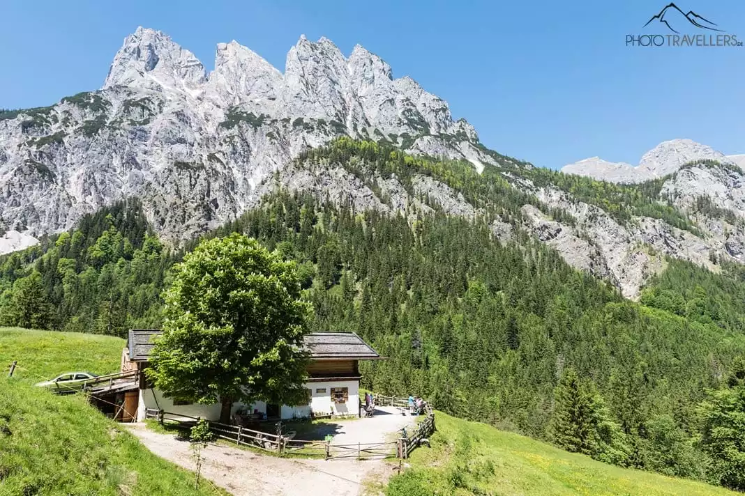
10. Litzlalm
The Litzlalm (open daily from mid-May to mid-October) is located amid beautiful scenery and was a filming location for many regional films and TV series like “Der Bergdoktor” (translated: “The Mountain Doctor”).
Yes, the Litzlalm is the incarnation of everything you associate with a holiday in the mountains. The hike is pretty long and starts at the beautiful Hintersee. In the beginning, the trail runs alongside a rushing stream called Klausbach. After about an hour, you take the ascending path to the Litzlalm.
You’ll pass the Bindalm and the Gasthaus am Hirschbichl before arriving at your destination after three to three and a half hours. However, in this gorgeous scenery, time flies! If you don’t feel like hiking quite that far, just take the bus: the Almerlebnisbus will take you through the Klausbachtal valley all the way to Hirschbichl. From that stop, it’s only a short hike to the Litzlalm.
Extra tip: from the Litzlalm, it’s not far to the Litzlkogel (1625 m), from where you have another amazing view. By the way, the tour to the Litzlalm is also very popular among mountain bikers. This tip comes from Toni Wegschneider from Wildtier-Führungen, who offer hikes with experts on the wildlife of the Alps.
Total trail length: 16.6 kilometers (considerably shorter with the Almerlebnisbus) – Elevation gain: 530 meters
11. Stubenalm
The Stubenalm just below the mountain hut Watzmannhaus is also a popular destination among hikers. You can either start the tour at the Wimbach Bridge in Ramsau or the parking site Hammerstiel in Schönau.
From both locations, you can reach the Stubenalm in about one and a half hours. From there, you have an amazing view of the Reiter Alm and the Hochschwarzeck. Two alpine cabins offer food and drinks to hikers amid wonderful mountain scenery.
Total trail length: 6.0 kilometers – Elevation gain: 520 meters
12. Halsalm
The circular hike via the Halsalm starts from the lake Hintersee and leads you into the valley Klausbachtal at the beginning. Shortly after, you’ll have to turn right onto a broad, curvy path in the direction of Halsgrube. The Halsalm is open in summer and provides a stunning view of the Hintersee. You will descend through the Antonigraben, which does require some surefootedness.
Total trail length: 6.0 kilometers – Elevation gain: 440 meters
13. Ragert Alm
The hike to the Ragert Alm also starts from the Hintersee. The tour follows a simple trail through the wild and romantic valley Klausbachtal that’s well-known for its golden eagles. The trail to the Ragert Alm branches off at a wooden bridge, from where you should reach the alp in just 15 minutes.
Just follow the signposts. The trails are very nice and even suitable for families with small children. The hike is doable in about an hour. If that’s too far, you can also take the Almerlebnisbus through the Klausbachtal valley. Get out at the stop Ragert Alm and you will only have about 15 minutes left to walk.
Total trail length: 5.8 kilometers – Elevation gain: 90 meters
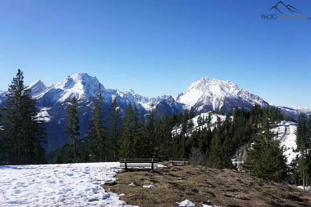
14. Jenner
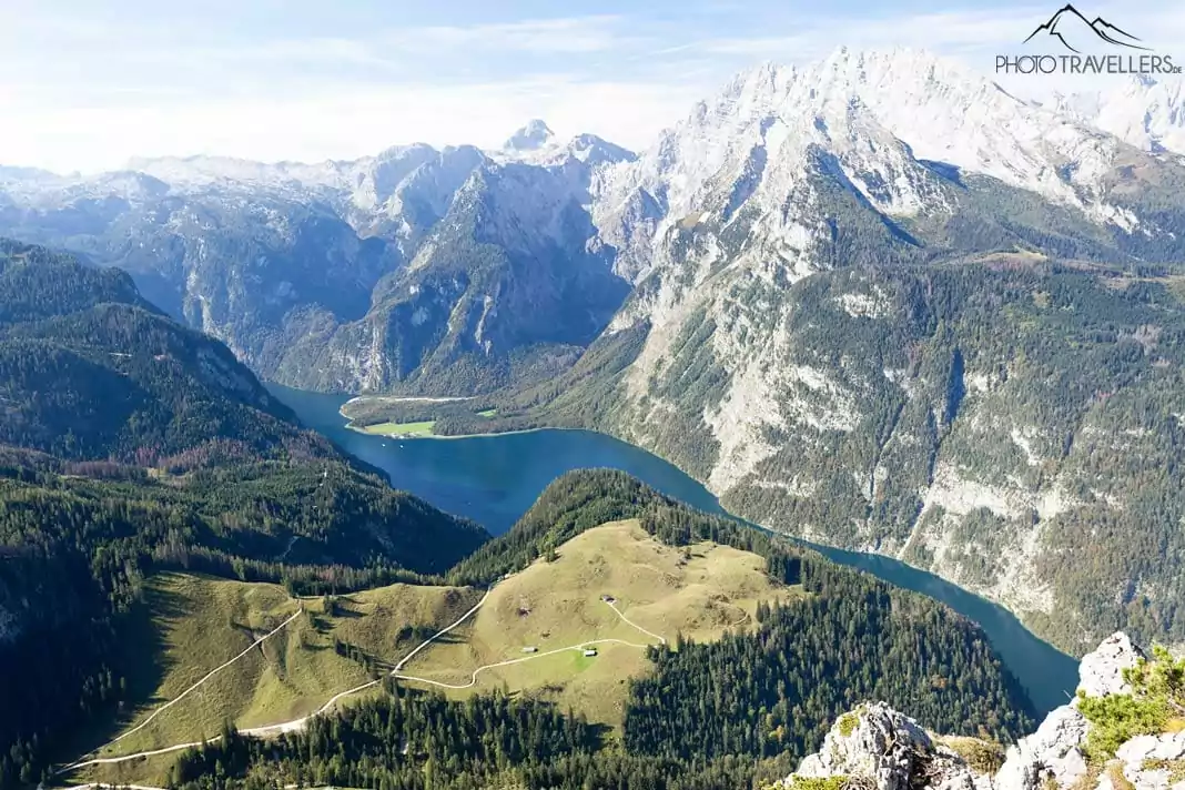
The Jenner is one of the most beautiful peaks in the Berchtesgadener Land. The view of the Königssee and the Watzmann is breathtaking. The cable car Jennerbahn will take you up to almost 1800 meters.
It takes around 20 minutes from the summit station to the actual peak. If you’re in for a real hike though, you’ll climb the mountain on foot. The starting point of the tour is the parking site Hinterbrand. You’ll follow the forest track to the middle station of the Jennerbahn and continue on the Königsweg, a forest road on which you’ll pass many alpine pastures and meadows. You can also combine the Jenner hike with the Schneibstein (#15 on our list).
Total trail length: 12.6 kilometers – Elevation gain: 750 meters
15. Schneibstein
Have you always wanted to climb a two-thousander but never dared to actually do it? The Schneibstein is the chance you’ve been waiting for. After all, it’s considered the easiest two-thousander in the Berchtesgaden Alps.
Following the Königsweg, the climb is pretty unproblematic from the middle station of the Jennerbahn (the parking site Hinterbrand requires a small fee) until you reach the mountain hut Carl-von-Stahl-Haus at 1736 meters. If you’ve decided to hike instead of taking the cable car, you should spend the night at the Stahl-Haus and tackle the Schneibstein peak the next day.
With more than 16 kilometers, the tour would otherwise be too long for beginners. From the Stahl-Haus, a nice mountain trail leads all the way up to the peak. Surefootedness is vital but the trail never really gets too difficult. When the Jennerbahn is operating (at the earliest in summer 2018), the hike is also well-manageable as a longer day-tour.
Total trail length: 16.2 kilometers – Elevation gain: 1160 meters
You might also be interested in